Photo by Laura Webb
You could say that
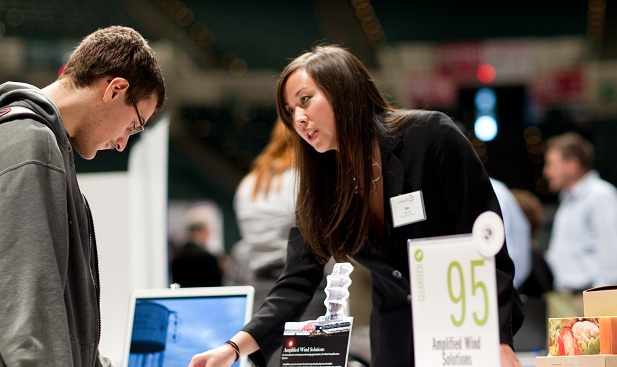
Amplified Wind Solutions CEO Niki Zmij has had a pretty good year. After taking second place in the student business idea competition at the 2012 Northeast Ohio Entrepreneur Expo, her cleantech company—whose technology was developed out of Cleveland State University, where she is an MBA student—
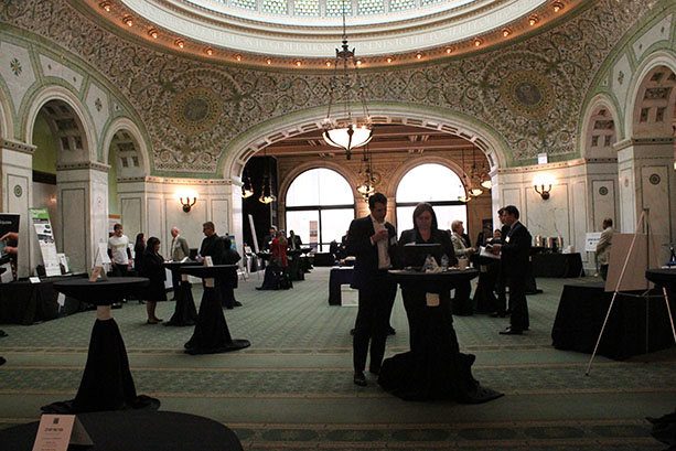
won the Ohio Clean Energy Challenge (and $10,000) and competed in the regional competition in Chicago.
At that Windy City event, Zmij
won the “Breaking Barriers in Cleantech” award for being an outstanding female entrepreneur. “I was definitely surprised, but mostly honored,” Zmij says of the award. “It was amazing to be welcomed on stage by a group of such strong, successful and intelligent women.” Amplified Wind Solutions’ technology isn’t that complex, but it is innovative—and could have a huge impact. As its name implies, the company’s system diverts wind around a cylinder, which increases air density and velocity—hence, creating amplified wind. Next, “our technology simply places turbines in front of that amplified wind,” Zmij explains, “and it can produce four to six times more electricity than a conventional turbine.” The company sees many applications for their system, with the biggest one potentially being the rapidly expanding telecommunications market. “Consumer demand in this industry is growing explosively,” Zmij explains. “Everybody and their brother has a cell phone. In order to keep up, telecom service providers are increasing their capacity and by building more towers both in the U.S. and in developing countries. As a result, powering these towers has been a growing strategic concern. “In order to find a solution, telecom providers are looking to clean energy technologies, including wind, solar and fuel cell,” she notes. “Our solution can provide energy at a fraction of the cost and, because the fuel is wind, the fuel is free.” Amplified Wind Solutions has received promising results from two prototypes in downtown Cleveland: one at Cleveland State University and the other one at the Cleveland Indians’ ballpark, Progressive Field. And, with a third prototype in the works, the company continues fundraising. Of course, the recent success in Chicago gave the company a positive boost. “There were many immediate positive results from the event, especially in the area of partner interest,” Zmij says. “We met many people who may be able to help us continue to develop within the telecom space, and also many who could help us access other markets down the line. “[But]
for me, Chicago reinforced the fact that there is always more work to do. There’s always more to learn and, in order to stay on top, you have to be flexible and you have to keep developing yourself, your business, your market and your product.”
See more about Amplified Wind Solutions in this video: http://www.youtube.com/watch?v=Up5dy1mK4Ug